Monday, June 27, 2011
Sunday, June 26, 2011
Rescue Practice Day
Today our club had Kerplunk Day witch is a day that beginners can come down and flip over their kayaks for the first time. This is with ACA Certified instructors and others around to assist. Once people get comfortable doing "wet exits" we move on to getting them back into the boat in at least 1 effective and consistent way. Some people start to learn to roll and others just watch. Today we had the opportunity to play in some surf about a 25 minute paddle away. We were told there were 3-4' waves off the tip of Tigertail Beach caused by the unusually strong ebbing tide and an onshore breeze.
We had a collection of paddlers with us in this group ranging from just starting to play in the waves to instructors and a few in between. 3 out of the 6of us could roll and all of us had an idea of how to self rescue and get assisted with 2 person rescues. After about 5 minutes of surfing we had two guys over with 3 of us capable of doing rescues but only me and another experienced at doing them in the surf. I rafted up with Sam and began to try and do a T rescue but quickly realized it was not going to happen in the surf we had because of the break. I did not have a tow rope on me as this was a impromptu surf session but was a lesson to be learned later.
I called Joseph over to tow us out of the surf zone but his tow was in his hatch and would not of been able to get it out in the waves so I called over Bill who had a quick tow on his vest. During the hooking up to tow, the waves were slamming the boats around while I tried to keep my boat and Sam's as locked up as possible. Originally Sam was on the lee side of the boat and I had to have him duck a few times to avoid the waves smashing his face with the boats. I then had him move to the bow and wrap himself around both boats. This kept us together much better and allowed Bill to begin to hook up again.
Once Bill was ready to tow, I had Sam keep on my bow and begin to use a contact tow method, pushing him as I paddled. Due to the current rushing out from the Big Marco River I could not paddle and make headway and could not use the waves to my advantage to surf down. Trying to let the waves move me I had Sam move to the top of my back deck and finally we started moving a little. Once we were in the shallows and about 50 feet from shore I made sure Sam was good to go and had him swim the rest with two guys on the beach to grab him.
I went back out to help keep Sam's boat in tow upright and finally got all of us to the beach. We quickly went through what we had done wrong, what we should have had with us and what we would have done differently. I realized this entire time I was filming as well so here is a video of the attempted rescue.
Notice just how long it took to do. Granted doing it over it would have gone faster but it's clear that anything in conditions is going to be a completely different ball game from the rescue practice we were doing on flat water half an hour previous to surfing. I lost Sam off the boat a couple times in the waves and had to have Joseph get him back to them once. Certainly a bit tiring but a lot of fun.
-
JR
Tuesday, June 21, 2011
First Day of Clam Pass Kids Kayak Camp

Today was my first day back at the kayak camp we run with the Collier County Parks and Rec department. This is done at Clam Pass in Naples, FL and is a nice place to kayak. This is my third year doing the camp and is a lot of fun teaching the kids (ages 10-15) how to kayak and playing around in the water. I've gotten 4 or 5 kids rolling and most of these kids are here just as something to do in the summer. Below is a video of where we launch from.
The water outside the pass was beautiful today. This looked like The Keys type of clarity. Once the tide changed the water inside the pass looked that way as well.
One of the cool things about the Clam Pass area is the mangrove maze around it. You could certainly get lost in these. The trails are high tide creeks and at the center of them all is a large mud flat that, at times, is filled with Fiddler and Hermit Crabs. We took a walk here today then back to the pass to jump in. Thank god for a waterproof camera.
After having lunch we moved on to some balance drills with kids doing their best to stand up and paddle their boats from the cockpit. Some actually got it right away while others are still working. After they got tired of waiting for me to get them back in their boats I taught them how to get back in there on their own. First we talked about getting the water out of their boats by lifting the bow while using the paddle on the opposite shoulder to keep them up in the water. By the end of that the rest of the group was heading back so we chased them down and landed safely back at the launch.
Monday, June 20, 2011
3rd Sunday Club Paddle in Naples, FL
Every 3rd Sunday of the month our paddle club, the Paradise Coast Paddlers Club, meets at the Isles of Capri Fish House for our easy recreational paddle for all skill levels. The group tends to break into 2-3 speed groups and convenes on Sea Oat Island for swimming, hanging on the beach or for some, rolls and rescues.
This was the first real time out with my new GoPro HD Hero and I wanted to get some real test footage in of some rescues and rolls. Here is a short rolling compilation taken from someone standing in the water with the camera. I've also been playing around with the camera on my boat. Here are the videos.
Stay tuned for lots more to come
JR
Saturday, June 18, 2011
Trip Report - Acadia National Park Circumnavigation 2010
In September of 2010 I headed up to Bar Harbor with my buddy Mango from Osprey Sea and Surf Adventures in Westport, MA. Mango owned a P&H Scorpio and the shop was nice enough to provide another for me to use for the trip. So there we were matching Scorpio's one Orange, one Yellow. I had taken on the plane with me a Seals Gear bag filled with my PFD, tow line, spray skirt, numerous dry bags, Spot Tracking Device and my Werner Ikelos. I was leaving high 90 degree weather in Naples and was expecting Maine to be pretty nice. I packed some warm clothing but besides a dry top left all warm paddling gear at the house. The week prior to me getting up there Maine was unusually hot being in the high 80's each day with some in the 90's so I was confident I'd be fine.
We packed up all the gear in Mango's vehicle and headed towards Acadia National Park. This was our second visit in 3 years. This was bound to be drastically different that the first. That time we were still in our first kayaks, mine a 16'6'' Venture Skye and him in a 9'6'' Old Town Otter with no bulkheads. We spent 3 days exploring the Pretty Marsh Area and were blown away enough to know we'd be coming back. We have since go on to own multiple different boats, become certified ACA and BCU paddlers and much more.
Stopping somewhere in a small town of Maine we stocked up on all last minute gear with sights on Acadia. Rest stop on the way up hosted a trailer full of brand new NDK's. Due to a somewhat late start and not being in a huge rush we arrived at dark and I quickly realized my Florida blood was not used to being back up North and I was freezing! After some more last minute purchases of some warmer clothing, a fleece hat and some paddling pants we were back on schedule. Grabbed a bite to eat at the Route 66 Restaurant and the experience began. While charting out our potential routes we were approached by a local worker named Champ that asked about the trip. He then asked if it would be weird for him to pray for us right there at the table for our trip. We hesitantly said no, he did his thing and we ate up then headed to the campground for the first night.

The Carpe Diem Sea Kayak Symposium was going on at the same time so we half expected to see kayaks all over the place and there were a good amount but from the vehicle you can only see so many. Bar Harbor the next morning was beautiful. A cruise ship was in the harbor and the weather was wonderful, now that I was properly dressed. The town of Bar Harbor seems to be one I could spend a long long time in. Summer is gorgeous up there but winters can be nasty.

The night we got in camping was a bit chilly. 40 degrees at night left me warm but not comfortable and had a lousy sleep. Was hoping it wouldn't be a trend. We were on the water around 10am the first day. We decided on launching from Otter Cover. The Park Rangers were kind enough to allow us to park on a small turn that is used for launching park boats. It was a bit of a hike over the rocks to get in the water but nothing terrible. With the boats finally loaded and pre launch checks we headed of planning on circumnavigating the Island clockwise. It became clear quickly the dry top and paddlers pants would be staying on the duration of this trip. I had forgotten how cold the water was in Maine!

The cove we launched from itself was lined with granite cliffs that were pretty amazing. Instantly as we rounded the corner the cliffs towered overhead. We passed Seal Harbor and took a Jaunt across the channel to Bear Island which is a cliff that stick out of the water with a lighthouse and dense forest on top. This is at least 25 feet up from the water and closed to the public. We spotted a whale watch boat and hoped for the unlikely chance he "drew" some whales over with him but did not and pressed on towards Somes Sound. With darkness about an hour and a half a way camp became priority and we began to search for a suitable place to set up. On the North side of Valley Cove sits Acadia Mountain and at the base of it a perfect landing rock was waiting for us with only a 4 foot climb for the boats and the gear.
 The next morning we awoke to about a 15 foot drop to the water from where it had previously been about 4. Tides were a lot different than what we're used to here in Naples. After the tide rose a bit we headed South out of the Sound and down towards The Gott Islands to explore. Coming up on Black Island I was able to get out of the boat and up the cliff a bit to take a picture looking down on Mango showing just how clear the water was.

At the tip of Black Island to the South lies Little Black Island. Enter camping heaven. This rather small island is propped up surrounded by rock but with a bar that goes between it and it big brother Black Island at low tide that allows an easy walk to the top with boats. The top camping area was all grassy, soft and wonderful to sleep on. Fires were permitted here but only on the rocks beneath the high tide line and that worked for us. This was a beautiful island with nearly nothing between us and Europe looking out besides the ocean. After exploring around a lot and cooking dinner we downed a bottle of wine and fell asleep.


Next morning we headed off towards the Green Islands, which are really just large rocks sticking out of the ocean. Surrounding these rocks were dozens and dozens of seal. As we rounded the rocks more and more of them were appearing and curiously looking at us. IT felt like being in a sea world exhibit. After playing with the Seal for a while next stop were the Sister Islands. On the Western Sister we discovered an old fishing shanty that looked like it hadn' t been used in the last 6 years or so based on newspapers inside. The island itself boded well for a camp site so we decided to camp near the rock beach and have a good fire that night with plenty of wood around.


We wake the next morning to the sound of rain on the tents and a storm rapidly approaching with lots of extremely loud thunder on Swan Island NW of us. Judging by the outlook we need to get to the main land and fast so we pack up quickly and paddle like crazy across to Placentia Island and then across to Bass Harbor. We needed to get more water anyway so we pulled into the Port near the ferry as it was doing the same. No stores in sight so we walked a mile to "town" where a restaurant waitress looked us up and down with a funny face then let us fill our Dromedary Bags with water.

The next leg of the journey was nearing where our first had ended a few years back. We passed by Duck then Goose cove on the way to the beach around Western Tremont to find everything as we had left it 3 years prior. The tripod of logs to hold the pot over the fire. The log for sitting near the fire pit and the rocks that lined it. All had been sitting there, possibly with know one else seeing them, for all that time. We had lunch here, our usual Flat Bread with Peanut Butter, Honey, Nutella and Granola and reminisced on the trips of the past and how naive we were back then in comparison.

Next stop was for us to come into Pretty Marsh area where we had first launched during our that amazing first visit here. Pretty Marsh is an area where the ocean becomes to get sheltered and though still can be rough most times is flat, smooth, crystal clear water with beautiful boats moored out and mountains on either side of you. As we left this area we realized what took us three days the first time here had just taken us 3 hours on this trip.....
Just before we rounded the NW side of Mt. Desert Island and entered Western Bay we could see a storm rapidly approaching. Normally this is when we grin, sit up straight and go for a wild ride but after the morning storm and the amount of lightning that came with it we look for camp. We found a suitable place in a small inlet leading to a creek with glass smooth water and began to quickly unload the boats and set up the tents and the tarp. We were not quick enough and had some of the gear get wet and of course all of the wood around us was too. No fire, no drying off the clothes, no fun. This night we both turned in very early. The next morning we awoke to the sun being hidden by the fog and could still not get our gear dried off or get a fire going. All of a sudden a few rays of sun sank through and landed on the rock at then end of the beach we were on. Rapidly the wet gear was laid out to dry and we did our best to no start out day wet. Thankfully that was almost the case.

 Weather was nice and no rain in sight so we departed feeling much better than the previous night.The tide was going to shift and begin to ebb an hour after we set off so we knew we needed to get under the Mt Desert Narrows under the bridge leading onto the island with some urgency. We had just under 5 miles to get there. About 2 miles into it the a 18knt headwind had built up and was making the beginnings of our day not as enjoyable as we would have liked. As we neared the narrows we spotted another large collection of Seal and stopped to rest while enjoying the view. With 20 minutes to spare before the change we made it under the narrows and across to the NE side of the island. Lunch was decided on and we stopped on a rocky beach around Hulls Cove. With 3 hours of daylight left and a 1/4 of the island left we debated on whether to keep going or stop and try to find a camp site. The chart wasn't showing anything promising and we were less than 4 miles from the Bar Harbor and only a few more miles away from the famous cliffs section we were so looking forward too.


After going back and forth a few times we decided to make a run for it. The cliffs were drawing us in and we were ready to go eat some pizza! Passing by the Nova Scotia Cat (not currently in service) in Bar Harbor we paddled over the Breakwaters going to the Porcupines and headed towards the Ocean. The Thrumcap, a massive rock jetting out of the ocean, became our first landmark to hit. The cliff faces rose higher and higher from the water as we paddled closer to the bottom. Large but smooth Ocean swells rolled in under us gently and smacked the cliffs with a low rumbling boom over and over again. We were able to play a little bit going through some rock areas but loaded boats allowed us to only do so much.


Passing the Thrumcap around the corner we marveled at the cliff face of Schooner and Great Head. As we got further down we paddled in to check out the Thunder Hole, an area both of us had seen from land before but not from the water. Crowds gathered as they were shocked to see long skinny boats with people paddling them so close to the rocks but it was wonderful. The cameras flashed as we showed off a little and began the last pull back to where we started 5 days earlier. Otter Cliff cam into view and we rounded the headland back to the cove in which it all began. This was as one of the most beautiful sunsets I had ever seen was setting over the Southern tip of Cadillac Mountain. A sense of accomplishment not from the miles but from the sheer sensory overload the trip threw at us.


That night we got our pizza and decided to spend the last night camping at the campsite we stayed at in Bar Harbor the night we got in. The next morning we drove to the top of Cadillac Mt. and got to see from the air all we had just paddled through 1500 feet below us. Very cool.

JR
We packed up all the gear in Mango's vehicle and headed towards Acadia National Park. This was our second visit in 3 years. This was bound to be drastically different that the first. That time we were still in our first kayaks, mine a 16'6'' Venture Skye and him in a 9'6'' Old Town Otter with no bulkheads. We spent 3 days exploring the Pretty Marsh Area and were blown away enough to know we'd be coming back. We have since go on to own multiple different boats, become certified ACA and BCU paddlers and much more.
Stopping somewhere in a small town of Maine we stocked up on all last minute gear with sights on Acadia. Rest stop on the way up hosted a trailer full of brand new NDK's. Due to a somewhat late start and not being in a huge rush we arrived at dark and I quickly realized my Florida blood was not used to being back up North and I was freezing! After some more last minute purchases of some warmer clothing, a fleece hat and some paddling pants we were back on schedule. Grabbed a bite to eat at the Route 66 Restaurant and the experience began. While charting out our potential routes we were approached by a local worker named Champ that asked about the trip. He then asked if it would be weird for him to pray for us right there at the table for our trip. We hesitantly said no, he did his thing and we ate up then headed to the campground for the first night.
The Carpe Diem Sea Kayak Symposium was going on at the same time so we half expected to see kayaks all over the place and there were a good amount but from the vehicle you can only see so many. Bar Harbor the next morning was beautiful. A cruise ship was in the harbor and the weather was wonderful, now that I was properly dressed. The town of Bar Harbor seems to be one I could spend a long long time in. Summer is gorgeous up there but winters can be nasty.
The night we got in camping was a bit chilly. 40 degrees at night left me warm but not comfortable and had a lousy sleep. Was hoping it wouldn't be a trend. We were on the water around 10am the first day. We decided on launching from Otter Cover. The Park Rangers were kind enough to allow us to park on a small turn that is used for launching park boats. It was a bit of a hike over the rocks to get in the water but nothing terrible. With the boats finally loaded and pre launch checks we headed of planning on circumnavigating the Island clockwise. It became clear quickly the dry top and paddlers pants would be staying on the duration of this trip. I had forgotten how cold the water was in Maine!
The cove we launched from itself was lined with granite cliffs that were pretty amazing. Instantly as we rounded the corner the cliffs towered overhead. We passed Seal Harbor and took a Jaunt across the channel to Bear Island which is a cliff that stick out of the water with a lighthouse and dense forest on top. This is at least 25 feet up from the water and closed to the public. We spotted a whale watch boat and hoped for the unlikely chance he "drew" some whales over with him but did not and pressed on towards Somes Sound. With darkness about an hour and a half a way camp became priority and we began to search for a suitable place to set up. On the North side of Valley Cove sits Acadia Mountain and at the base of it a perfect landing rock was waiting for us with only a 4 foot climb for the boats and the gear.


At the tip of Black Island to the South lies Little Black Island. Enter camping heaven. This rather small island is propped up surrounded by rock but with a bar that goes between it and it big brother Black Island at low tide that allows an easy walk to the top with boats. The top camping area was all grassy, soft and wonderful to sleep on. Fires were permitted here but only on the rocks beneath the high tide line and that worked for us. This was a beautiful island with nearly nothing between us and Europe looking out besides the ocean. After exploring around a lot and cooking dinner we downed a bottle of wine and fell asleep.


Next morning we headed off towards the Green Islands, which are really just large rocks sticking out of the ocean. Surrounding these rocks were dozens and dozens of seal. As we rounded the rocks more and more of them were appearing and curiously looking at us. IT felt like being in a sea world exhibit. After playing with the Seal for a while next stop were the Sister Islands. On the Western Sister we discovered an old fishing shanty that looked like it hadn' t been used in the last 6 years or so based on newspapers inside. The island itself boded well for a camp site so we decided to camp near the rock beach and have a good fire that night with plenty of wood around.


We wake the next morning to the sound of rain on the tents and a storm rapidly approaching with lots of extremely loud thunder on Swan Island NW of us. Judging by the outlook we need to get to the main land and fast so we pack up quickly and paddle like crazy across to Placentia Island and then across to Bass Harbor. We needed to get more water anyway so we pulled into the Port near the ferry as it was doing the same. No stores in sight so we walked a mile to "town" where a restaurant waitress looked us up and down with a funny face then let us fill our Dromedary Bags with water.

The next leg of the journey was nearing where our first had ended a few years back. We passed by Duck then Goose cove on the way to the beach around Western Tremont to find everything as we had left it 3 years prior. The tripod of logs to hold the pot over the fire. The log for sitting near the fire pit and the rocks that lined it. All had been sitting there, possibly with know one else seeing them, for all that time. We had lunch here, our usual Flat Bread with Peanut Butter, Honey, Nutella and Granola and reminisced on the trips of the past and how naive we were back then in comparison.

Just before we rounded the NW side of Mt. Desert Island and entered Western Bay we could see a storm rapidly approaching. Normally this is when we grin, sit up straight and go for a wild ride but after the morning storm and the amount of lightning that came with it we look for camp. We found a suitable place in a small inlet leading to a creek with glass smooth water and began to quickly unload the boats and set up the tents and the tarp. We were not quick enough and had some of the gear get wet and of course all of the wood around us was too. No fire, no drying off the clothes, no fun. This night we both turned in very early. The next morning we awoke to the sun being hidden by the fog and could still not get our gear dried off or get a fire going. All of a sudden a few rays of sun sank through and landed on the rock at then end of the beach we were on. Rapidly the wet gear was laid out to dry and we did our best to no start out day wet. Thankfully that was almost the case.


After going back and forth a few times we decided to make a run for it. The cliffs were drawing us in and we were ready to go eat some pizza! Passing by the Nova Scotia Cat (not currently in service) in Bar Harbor we paddled over the Breakwaters going to the Porcupines and headed towards the Ocean. The Thrumcap, a massive rock jetting out of the ocean, became our first landmark to hit. The cliff faces rose higher and higher from the water as we paddled closer to the bottom. Large but smooth Ocean swells rolled in under us gently and smacked the cliffs with a low rumbling boom over and over again. We were able to play a little bit going through some rock areas but loaded boats allowed us to only do so much.


Passing the Thrumcap around the corner we marveled at the cliff face of Schooner and Great Head. As we got further down we paddled in to check out the Thunder Hole, an area both of us had seen from land before but not from the water. Crowds gathered as they were shocked to see long skinny boats with people paddling them so close to the rocks but it was wonderful. The cameras flashed as we showed off a little and began the last pull back to where we started 5 days earlier. Otter Cliff cam into view and we rounded the headland back to the cove in which it all began. This was as one of the most beautiful sunsets I had ever seen was setting over the Southern tip of Cadillac Mountain. A sense of accomplishment not from the miles but from the sheer sensory overload the trip threw at us.


That night we got our pizza and decided to spend the last night camping at the campsite we stayed at in Bar Harbor the night we got in. The next morning we drove to the top of Cadillac Mt. and got to see from the air all we had just paddled through 1500 feet below us. Very cool.

JR
Thursday, June 16, 2011
Perception of Skill and Just How Good You Actually Are
Eventually, if you're lucky enough, there will be a time that you paddle with someone who, directly or indirectly, shows you how little you actually know about kayaking in the grand scheme of things. And hopefully, that drives you to push yourself further. This can happen to nearly any level of paddler because there is almost always someone better than you. Nothing demonstrates this better than attending a high level instructional certification to run through rescues and strokes you are completely comfortable with to see that with minor variables everything can be different.
When paddling for a while towards the higher skill levels there comes a point that, paddling wise, there aren't major differences between high level paddlers and advanced paddlers. The difference comes with the ability to take these skills and seamlessly transfer them to whatever condition or situation is thrown at you and continue to make it look easy. I consider myself a halfway decent paddler and very comfortable with rescues. Comfortable to the point that when practicing on the flat water lakes it feels video quality. It's interesting to watch a video of yourself in the real world demonstrate them though and see the minor differences you don't feel during the rescue stick out while watching it.
On the flip side of things it's doubly interesting to be in the presence of people who think they know what they are doing but do not. I had two cases of this today with lessons this morning and afternoon. Thankfully the students were receptive and quickly adapted to the proper techniques. Converting someone's bad habits or watching someone doing the forward stroke finally rotate and see the light is a beautiful thing. Almost as good as learning it yourself.
The brave souls that stick out the heat in Southern Florida continue to do lessons and I'll continue to teach them. Meanwhile I continue to plan a more Epic journey for the early fall than the last one and hope to learn something from it. After all, that is the goal isn't it.
JR
Wednesday, June 15, 2011
Trip Report - Solo Florida Keys June 2010
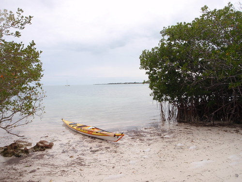
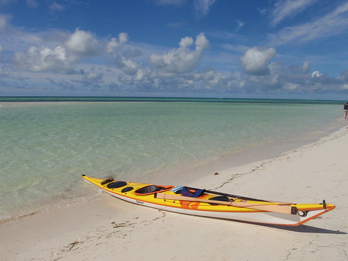
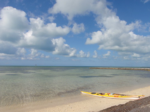
Last June I decided to paddle the Florida Keys solo from Key Largo to Key West. I was dropped off at John PenneKamp State Park and headed out from there. Here is the trip report and a few pictures from it.
Day 1: 9 hours – 26 miles
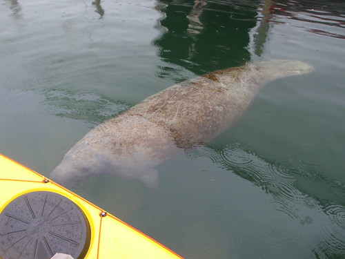
Launched from John PenneKamp State Park and was on the water by 10:00. Grey day with big storms brewing out over the Atlantic. I had a bout a 2.5 foot chop most of the ride and was staying cool due to the weather. Stopped in Tavernier Key to have lunch at a marina there and was welcomed by a huge manatee under my boat.
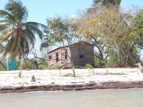
Fought the 6knt channel back out to the ocean and pressed on. I hadn’t paddled in at least a week and had not done a 20 miles paddle in over a month. I was feeling a little tired by the 20 miles point. Finding a camping spot in the upper keys is more difficult than the lower. Could not wait to find a non Mangrove island. Reached Indian Key around 7:00 and was thrilled to be there. I set up camp and spent the night.
Day 2 :11 hours – 31 miles
Woke up around 6:30 and explored the Island a little. Old cisterns, cottage remains and a watch tower were spread out across the island.
Path roadways connected the whole thing a made a very cool experience. Got on the water by 8:00 and headed for Marathon over 30 miles away. Headed off and stopped to take a lunch at Lower Matecumbe Harbor. Had my first of a series of medium crossings.
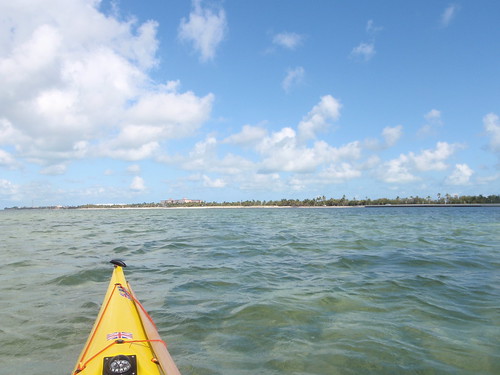
Took off for a 4.5 miles crossing from Lower Matecumbe Key to the outside tip of Long Key. The wind and chop were in my face and continued that way for the first 3/4 of the day. Crossed pass Duck Key, Curry Hammock State Park and finally did one more long crossing from Key Colony Beach to Vaca Key where I followed Sister Creek into Boot Key Harbor. I met up with Mike, Nancy and Randy from Burdine’s Marina for a wonderful meal and nights stay in preparation for the 7 mile bridge the next morning. I had seen over a dozen shark by the end of the day
Day 3: 10 hours – 40 miles
Got up around 6:30 and a had a quick breakfast and shower and said goodbye to my most hospitable hosts at Burdine’s.

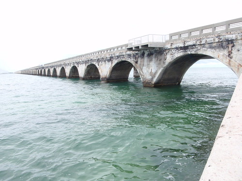
Once about 20 minutes out in to the Seven Mile Bridge crossing the wind and swell picked up nicely. Forecasted 25knt winds from the E, SE were spot on and I had a rocketing 3.5-4′ swell following me almost directly at my stern. An ear to ear grin came upon me as I surfed the Cetus LV like a mad man for the rest of the day. Crossing took 1hr and 20min to complete and I was on my way headed towards the beautiful Bahia Honda State Park.
Took a 30 minute swim and consulted the charts thinking, did I really do that crossing that fast. The Cetus surfs like none other. Here the trip really started to get good. Took off again and stopped before my last big crossing of the trip. Ate a snack at Big Munis Island where there is a private resort reachable only by boat (kayaks anyone) and marveled at its beauty.
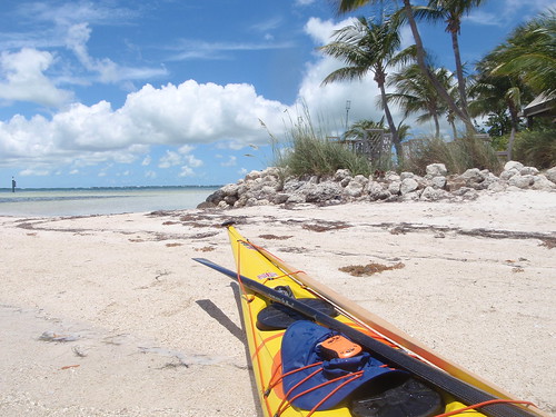
Got back out a mile and a half to catch the wind and swell again and surfed the 8.5 miles crossing from Munis to Sugerloaf Key where I planned to camp. Google maps had shown an almost empty large beach called Sugerloaf beach and looked very inviting. As I surfed with fury across I almost missed the beach due to it not looking anything like I thought it would! Houses all over the place and all private. The only houses that were not occupied were the hurricane ravaged ones on the west side.
Noticing 2′ plus iguanas all over the place I though better of camping there and decided to press on past the 34 miles I had already gone. A strong day of surf assisted paddling left me feeling still pretty energetic. Pressed on to Geiger Key where I took out unhappy of all the rest stops I carelessly took after noticing the great time I was making. Had I not I would have made Key West on the 3rd day!
Day 4: 1.5 hours – 6 miles
Got back on the water to complete my journey at 8:30 and paddled my last 6 miles to Smather’s Beach on Key West by 9:50.
At this point 6 miles felt like not even getting in the boat. As I pulled up on the beach and got out in wait of my ride home to Naples I marveled at my first solo trip and how luck I was to have the boat that I do.
This entry was posted on Sunday, May 23rd, 2010 at 3:47 pm and is filed under Day Trps.
Day 1: 9 hours – 26 miles
Launched from John PenneKamp State Park and was on the water by 10:00. Grey day with big storms brewing out over the Atlantic. I had a bout a 2.5 foot chop most of the ride and was staying cool due to the weather. Stopped in Tavernier Key to have lunch at a marina there and was welcomed by a huge manatee under my boat.
Fought the 6knt channel back out to the ocean and pressed on. I hadn’t paddled in at least a week and had not done a 20 miles paddle in over a month. I was feeling a little tired by the 20 miles point. Finding a camping spot in the upper keys is more difficult than the lower. Could not wait to find a non Mangrove island. Reached Indian Key around 7:00 and was thrilled to be there. I set up camp and spent the night.
Day 2 :11 hours – 31 miles
Woke up around 6:30 and explored the Island a little. Old cisterns, cottage remains and a watch tower were spread out across the island.
Path roadways connected the whole thing a made a very cool experience. Got on the water by 8:00 and headed for Marathon over 30 miles away. Headed off and stopped to take a lunch at Lower Matecumbe Harbor. Had my first of a series of medium crossings.
Took off for a 4.5 miles crossing from Lower Matecumbe Key to the outside tip of Long Key. The wind and chop were in my face and continued that way for the first 3/4 of the day. Crossed pass Duck Key, Curry Hammock State Park and finally did one more long crossing from Key Colony Beach to Vaca Key where I followed Sister Creek into Boot Key Harbor. I met up with Mike, Nancy and Randy from Burdine’s Marina for a wonderful meal and nights stay in preparation for the 7 mile bridge the next morning. I had seen over a dozen shark by the end of the day
Day 3: 10 hours – 40 miles
Got up around 6:30 and a had a quick breakfast and shower and said goodbye to my most hospitable hosts at Burdine’s.
Once about 20 minutes out in to the Seven Mile Bridge crossing the wind and swell picked up nicely. Forecasted 25knt winds from the E, SE were spot on and I had a rocketing 3.5-4′ swell following me almost directly at my stern. An ear to ear grin came upon me as I surfed the Cetus LV like a mad man for the rest of the day. Crossing took 1hr and 20min to complete and I was on my way headed towards the beautiful Bahia Honda State Park.
Took a 30 minute swim and consulted the charts thinking, did I really do that crossing that fast. The Cetus surfs like none other. Here the trip really started to get good. Took off again and stopped before my last big crossing of the trip. Ate a snack at Big Munis Island where there is a private resort reachable only by boat (kayaks anyone) and marveled at its beauty.
Got back out a mile and a half to catch the wind and swell again and surfed the 8.5 miles crossing from Munis to Sugerloaf Key where I planned to camp. Google maps had shown an almost empty large beach called Sugerloaf beach and looked very inviting. As I surfed with fury across I almost missed the beach due to it not looking anything like I thought it would! Houses all over the place and all private. The only houses that were not occupied were the hurricane ravaged ones on the west side.
Noticing 2′ plus iguanas all over the place I though better of camping there and decided to press on past the 34 miles I had already gone. A strong day of surf assisted paddling left me feeling still pretty energetic. Pressed on to Geiger Key where I took out unhappy of all the rest stops I carelessly took after noticing the great time I was making. Had I not I would have made Key West on the 3rd day!
Day 4: 1.5 hours – 6 miles
Got back on the water to complete my journey at 8:30 and paddled my last 6 miles to Smather’s Beach on Key West by 9:50.
At this point 6 miles felt like not even getting in the boat. As I pulled up on the beach and got out in wait of my ride home to Naples I marveled at my first solo trip and how luck I was to have the boat that I do.
This entry was posted on Sunday, May 23rd, 2010 at 3:47 pm and is filed under Day Trps.
First Blog Post - Goings On and Some Background
Well, here goes my foray into the world of blogging. After going back and forth between what would work best for me web wise I decided on a combination approach with this blog being the main way to get content to the rest of the world.
So to introduce myself, my name is Jay Rose and I am a Sea Kayaker. I started paddling in the early summer of 2007 paddling the coastal waters of Massachusetts, Maine and Rhode Island. Falling in love with rough water early I put my focus on surfing, rescues and putting in distance as well. After 6 months of great paddles including Newport's southern cliffs (RI), Sakonnet Point (RI), Acadia National Park (ME) and Buzzards Bay (MA), I moved to Naples, FL. I began working at Saltwater Sports (now Naples Kayak Company) a day or two a week and quickly transitioned into that being my career and shifting my focus to instruction. I attended my first ACA Certification in May of 2008 with Becky Molina and discovered Greenland Paddling.
My love for Greenland Paddling grew and grew and I brought that with me to the local paddling community down here in Naples. There is now a large Greenland following down here and many people who had never thought to do so are taking up rolling! I have since gone on to get My ACA Level 2 Instructor Certification with a Level 4 Paddling Assessment, become a P&H Sea Kayaks Team Paddler. Last weekend I also achieved my BCU 3 Star Award and am now the Director of Operations at Naples Kayak Company.
This blog is designed to share my experiences, the good and bad, with a kayak and where it has brought me. Thanks for reading.
-
JR
Subscribe to:
Posts (Atom)